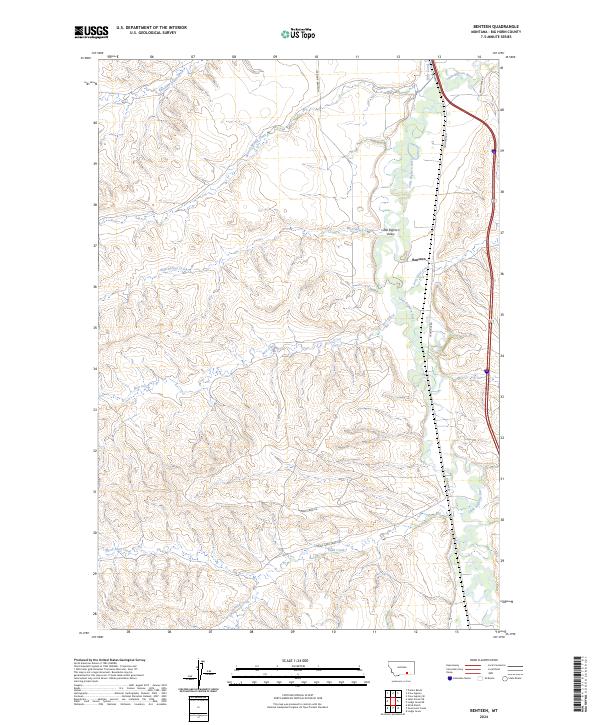
2024 Map of Benteen
USGS Topo · Published 2024About this map
The Little Bighorn River cuts a lush path through the center of this Big Horn County landscape, supporting a ranching and agricultural economy centered on the settlement of Benteen. The river's influence is reinforced by the Reno Canal, which traces the eastern valley edge to provide irrigation for the Little Bighorn Valley. Surrounding the riparian corridor, the terrain rises into a series of drainages and ridges, including Shoulder Blade Creek and Bear-in-Middle Creek to the northwest, and a complex network of southern waters like Sand Creek and South Sand Creek.
Find a feature on this map
30 named features on this map. Tap any name to fly to it.
Don’t see what you’re looking for? This feature index may not catch every label — zoom into the map to look around manually.
Map Details
Editions of this 2024 Benteen Map
This is the sole edition of this map. No revisions or reprints were ever made.
Other maps of this area

1894 · Rosebud
USGS Topo · 1:125,000

1894 · St. Xavier
USGS Topo · 1:125,000

1894 · Fort Custer
USGS Topo · 1:125,000

1901 · Rosebud
USGS Topo · 1:125,000

1901 · St. Xavier
USGS Topo · 1:125,000

1954 · Hardin
USGS Topo · 1:250,000

1957 · Hardin
USGS Topo · 1:250,000

1958 · Hardin
USGS Topo · 1:250,000

1960 · Schick Ranch
USGS Topo · 1:24,000

1960 · St Xavier NE
USGS Topo · 1:24,000