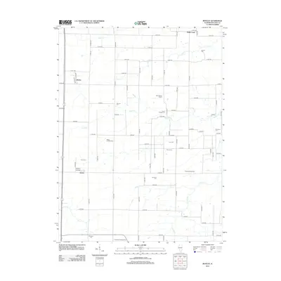
2012 Map of Bentley
USGS Topo · Published 2012About this map
Agricultural patterns and family heritage define this portion of Hancock County as it appeared in the early 21st century. The village of Bentley and the community of Denver serve as the primary anchors for a landscape otherwise dominated by a precise grid of county roads and meandering waterways. Water drainage is defined by several systems, including Middle Creek, Bronson Cr, and Panther Cr, which cut through the farm plots.
Find a feature on this map
49 named features on this map. Tap any name to fly to it.
Don’t see what you’re looking for? This feature index may not catch every label — zoom into the map to look around manually.
Map Details
Editions of this 2012 Bentley Map
This is the sole edition of this map. No revisions or reprints were ever made.
Other maps of this area

1913 · Colchester
USGS Topo · 1:62,500

1933 · Carthage
USGS Topo · 1:62,500

1937 · Carthage
USGS Topo · 1:62,500

1946 · Augusta
USGS Topo · 1:62,500

1948 · Camp Point
USGS Topo · 1:62,500

1949 · Augusta
USGS Topo · 1:62,500

1958 · Burlington
USGS Topo · 1:250,000

1961 · Burlington
USGS Topo · 1:250,000

1963 · Burlington
USGS Topo · 1:250,000
1974 · Bentley
USGS Topo · 1:24,000