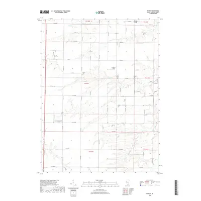
2018 Map of Bentley
USGS Topo · Published 2018About this map
Bentley and Denver anchor this rural Hancock County landscape, where the rectangular grid of the Public Land Survey System defines the placement of farmsteads and transport routes. The area is heavily marked by its pioneer-era heritage, as evidenced by a high density of small burial grounds including Old Sixteen Cem, Harmony Cem, and Groves Cem. These cemeteries are often located along the margins of creeks like Bronson Cr and Panther Cr, where the terrain breaks from flat prairie into more complex drainage patterns. The presence of Mc Pherson Airport amidst these fields highlights the continued importance of regional transit in the agricultural economy. The map reveals how local life is structured around numbered section lines and the seasonal flows of waterways such as Middle Creek and Slater Cr.
Find a feature on this map
62 named features on this map. Tap any name to fly to it.
Don’t see what you’re looking for? This feature index may not catch every label — zoom into the map to look around manually.
Map Details
Editions of this 2018 Bentley Map
This is the sole edition of this map. No revisions or reprints were ever made.
Other maps of this area

1913 · Colchester
USGS Topo · 1:62,500

1933 · Carthage
USGS Topo · 1:62,500

1937 · Carthage
USGS Topo · 1:62,500

1946 · Augusta
USGS Topo · 1:62,500

1948 · Camp Point
USGS Topo · 1:62,500

1949 · Augusta
USGS Topo · 1:62,500

1958 · Burlington
USGS Topo · 1:250,000

1961 · Burlington
USGS Topo · 1:250,000

1963 · Burlington
USGS Topo · 1:250,000
1974 · Bentley
USGS Topo · 1:24,000