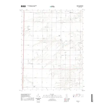
2021 Map of Bentley
USGS Topo · Published 2021About this map
Bentley and Denver serve as the primary nodes of settlement in this rural landscape, which is defined by a dense network of country roads and several distinct watercourses. The drainage patterns of Middle Creek, Little Cr, and Panther Cr carve through the agricultural tableland, creating a topography of gentle draws and creek beds. For those documenting local history, the area is notable for its numerous burial grounds, including the curiously named Old Sixteen Cem in the south and Holland Cem in the northeast. Small-scale aviation is represented by McPherson Airport, located near Mount Pleasant Cem. The map illustrates a strictly partitioned land system where East-West county roads, such as E Co RD 1200 and E Co RD 400, segment the territory into regular blocks, reflecting the enduring legacy of the Public Land Survey System in Illinois.
Find a feature on this map
42 named features on this map. Tap any name to fly to it.
Don’t see what you’re looking for? This feature index may not catch every label — zoom into the map to look around manually.
Map Details
Editions of this 2021 Bentley Map
This is the sole edition of this map. No revisions or reprints were ever made.
Other maps of this area

1913 · Colchester
USGS Topo · 1:62,500

1933 · Carthage
USGS Topo · 1:62,500

1937 · Carthage
USGS Topo · 1:62,500

1946 · Augusta
USGS Topo · 1:62,500

1948 · Camp Point
USGS Topo · 1:62,500

1949 · Augusta
USGS Topo · 1:62,500

1958 · Burlington
USGS Topo · 1:250,000

1961 · Burlington
USGS Topo · 1:250,000

1963 · Burlington
USGS Topo · 1:250,000
1974 · Bentley
USGS Topo · 1:24,000