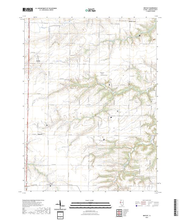
2024 Map of Bentley
USGS Topo · Published 2024About this map
Bentley and Denver anchor this agricultural landscape in Hancock County, where a dense grid of county roads connects scattered farmsteads and rural landmarks. The terrain is defined by the branching drainages of Middle Creek, Little Creek, and Bronson Creek, which carve gentle valleys through the prairie. For those researching family history, the map preserves the locations of numerous community burial grounds including Holland Cem, Mount Pleasant Cem, and the uniquely named Old Sixteen Cem located near the southern margin.
Find a feature on this map
55 named features on this map. Tap any name to fly to it.
Don’t see what you’re looking for? This feature index may not catch every label — zoom into the map to look around manually.
Map Details
Editions of this 2024 Bentley Map
This is the sole edition of this map. No revisions or reprints were ever made.
Other maps of this area

1913 · Colchester
USGS Topo · 1:62,500

1933 · Carthage
USGS Topo · 1:62,500

1937 · Carthage
USGS Topo · 1:62,500

1946 · Augusta
USGS Topo · 1:62,500

1948 · Camp Point
USGS Topo · 1:62,500

1949 · Augusta
USGS Topo · 1:62,500

1958 · Burlington
USGS Topo · 1:250,000

1961 · Burlington
USGS Topo · 1:250,000

1963 · Burlington
USGS Topo · 1:250,000
1974 · Bentley
USGS Topo · 1:24,000