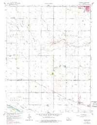
1958 Map of Bentley
USGS Topo · Published 1978About this map
Arkansas River bottomlands define the southern edge of this Central Kansas landscape, where the St Louis San Francisco railroad cuts through the small town of Bentley. The 1958 topography, later updated with photorevised urban footprints in the late 1970s, reveals a rural economy structured around water and transport. An extensive aqueduct and multiple pipelines crisscross the plains, indicating the complex engineering required to manage resources between the Harvey and Sedgwick County line. Local life is anchored by family-focused landmarks such as Bethany Ch, Grace Ch, and Enterprise Sch, while the presence of a Sandpit near the river and a prominent Water Tank in Bentley mark the industrial and municipal needs of the era. The meandering courses of Kisiwa Creek and Lakin Creek contrast with the rigid grid of section lines and the protective levee along the river.
Find a feature on this map
20 named features on this map. Tap any name to fly to it.
Don’t see what you’re looking for? This feature index may not catch every label — zoom into the map to look around manually.
Map Details
Editions of this 1958 Bentley Map
2 editions found
Other maps of this area

1889 · Newton
USGS Topo · 1:125,000

1889 · Cheney
USGS Topo · 1:125,000

1889 · Wichita
USGS Topo · 1:125,000

1891 · Hutchinson
USGS Topo · 1:125,000

1891 · Cheney
USGS Topo · 1:125,000

1893 · Hutchinson
USGS Topo · 1:125,000

1894 · Wichita
USGS Topo · 1:125,000

1894 · Newton
USGS Topo · 1:125,000

1901 · Cheney
USGS Topo · 1:125,000

1941 · Maize
USGS Topo · 1:31,680