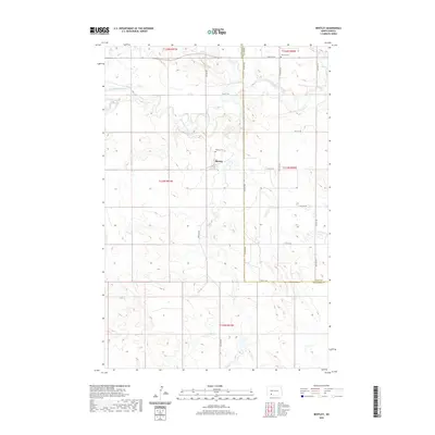
2020 Map of Bentley
USGS Topo · Published 2020About this map
Bentley serves as the central point of this southwestern North Dakota landscape, situated along the border of Grant and Hettinger counties. The terrain is defined by the winding course of the Cannonball River and its tributary, Thirty-mile Cr, which carve distinct drainage patterns across the prairie. This area shows a sparse settlement pattern typical of the region's agricultural character, with local life centered around the namesake townsite and its outlying infrastructure. Genealogists can identify key burial sites such as Odessa Cem in the north and Bentley Cem located just west of the main settlement. The survey documents a grid of rural thoroughfares, including Bentley Rd and 78th Ave Sw, providing a clear view of the land divisions and property access points during the early 21st century.
Find a feature on this map
21 named features on this map. Tap any name to fly to it.
Don’t see what you’re looking for? This feature index may not catch every label — zoom into the map to look around manually.
Map Details
Editions of this 2020 Bentley Map
This is the sole edition of this map. No revisions or reprints were ever made.
Other maps of this area

1953 · Dickinson
USGS Topo · 1:250,000

1954 · Bismarck
USGS Topo · 1:250,000

1957 · Dickinson
USGS Topo · 1:250,000

1958 · Bismarck
USGS Topo · 1:250,000

1969 · Burt
USGS Topo · 1:24,000

1969 · North Star Butte
USGS Topo · 1:24,000

1969 · Bentley
USGS Topo · 1:24,000
1969 · Burt NW
USGS Topo · 1:24,000

1972 · Coffin Buttes
USGS Topo · 1:24,000

1972 · New Leipzig South
USGS Topo · 1:24,000