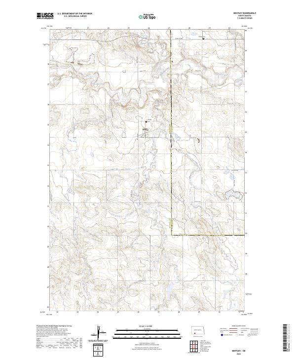
2024 Map of Bentley
USGS Topo · Published 2024About this map
The Bentley settlement serves as the focal point of this rural prairie landscape, positioned where Bentley Rd cuts through the rolling topography of southwestern North Dakota. This modern survey illustrates the persistent agricultural and township boundaries of the region, including the divide between Grant and Hettinger counties. The Cannonball River meanders across the northern half of the quadrangle, joined by the tributary waters of Thirtymile Creek. For genealogists and local historians, the map preserves the locations of vital community landmarks such as Bentley Cem near the townsite and Odessa Cem to the northeast. The surrounding landscape is defined by a rigid grid of rural routes, including 72nd St SW and 77th Ave SW, which reflect the enduring Public Land Survey System that shaped the settlement of the northern plains.
Find a feature on this map
22 named features on this map. Tap any name to fly to it.
Don’t see what you’re looking for? This feature index may not catch every label — zoom into the map to look around manually.
Map Details
Editions of this 2024 Bentley Map
This is the sole edition of this map. No revisions or reprints were ever made.
Other maps of this area

1953 · Dickinson
USGS Topo · 1:250,000

1954 · Bismarck
USGS Topo · 1:250,000

1957 · Dickinson
USGS Topo · 1:250,000

1958 · Bismarck
USGS Topo · 1:250,000

1969 · Burt
USGS Topo · 1:24,000

1969 · North Star Butte
USGS Topo · 1:24,000

1969 · Bentley
USGS Topo · 1:24,000
1969 · Burt NW
USGS Topo · 1:24,000

1972 · Coffin Buttes
USGS Topo · 1:24,000

1972 · New Leipzig South
USGS Topo · 1:24,000