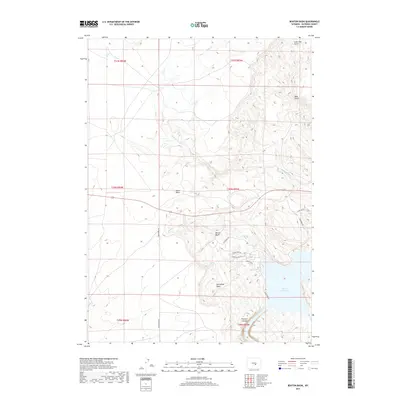
2017 Map of Benton Basin
USGS Topo · Published 2017About this map
Alcova Reservoir dominates the southeastern corner of this Natrona County landscape, where the North Platte River carves through the steep walls of Fremont Canyon. The surrounding terrain is defined by a series of distinct topographic depressions and drainages, including Benton Basin and Horseshoe Basin, which are separated by high ridges. This 2017 survey illustrates the accessibility of the reservoir shoreline, noting developed points like Sandy Beach and a network of access roads including Lakeview Rd and Cedar Mesa Rd. Further inland, the map captures the transition from these recreational areas to the more arid, remote stretches of Agate Basin and the winding course of Eagle Cr. Smaller water sources such as McCain Spring and seasonal drainages like Blue Gulch reflect the critical importance of water distribution in this high-desert environment.
Find a feature on this map
24 named features on this map. Tap any name to fly to it.
Don’t see what you’re looking for? This feature index may not catch every label — zoom into the map to look around manually.
Map Details
Editions of this 2017 Benton Basin Map
This is the sole edition of this map. No revisions or reprints were ever made.
Other maps of this area

1950 · Alcova
USGS Topo · 1:24,000

1951 · Clarkson Hill
USGS Topo · 1:24,000

1951 · Benton Basin SW
USGS Topo · 1:24,000

1951 · Benton Basin
USGS Topo · 1:24,000

1951 · Pathfinder Reservoir NW
USGS Topo · 1:24,000

1951 · Benton Basin NE
USGS Topo · 1:24,000

1951 · Mc Cleary Reservoir
USGS Topo · 1:24,000

1951 · Bear Spring
USGS Topo · 1:24,000

1951 · Pathfinder Dam
USGS Topo · 1:24,000

1955 · Casper
USGS Topo · 1:250,000