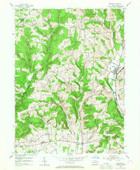
1953 Map of Benton
USGS Topo · Published 1967About this map
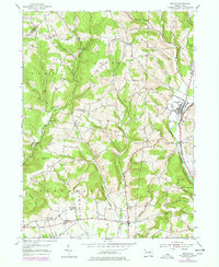
Fishing Creek and the Reading railroad line define the valley floor in this mid-century survey of Columbia and Lycoming Counties. The landscape is a network of ridges and hollows, where small agricultural hamlets like Rohrsburg, Greenwood, and Stillwater are connected by a web of state roads including Pa. 115. The geography is deeply personal, with terrain named for local families such as O'Brien Hill, Kramer Hill, and Davis Hill.
Find a feature on this map
43 named features on this map. Tap any name to fly to it.
Don’t see what you’re looking for? This feature index may not catch every label — zoom into the map to look around manually.
Map Details
Editions of this 1953 Benton Map
5 editions found
Other maps of this area

1894 · Bloomsburg
USGS Topo · 1:62,500

1927 · Eagles Mere
USGS Topo · 1:48,000

1932 · Eagle Mere
USGS Topo · 1:62,500

1934 · Laporte
USGS Topo · 1:62,500

1935 · Hughesville
USGS Topo · 1:62,500

1947 · Bloomsburg
USGS Topo · 1:24,000

1947 · Stillwater
USGS Topo · 1:24,000
1947 · Mifflinville
USGS Topo · 1:24,000

1947 · Benton
USGS Topo · 1:31,680
1953 · Bloomsburg
USGS Topo · 1:24,000