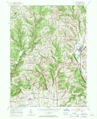
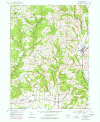
1953 Map of Benton
USGS Topo · Published 1971About this map
Benton and Stillwater anchor the eastern edge of this landscape, situated along the West Branch Fishing Creek during a period of transition in the mid-20th century. The terrain is defined by a series of narrow valleys and prominent heights like Bald Hill and O'Brien Hill, where small upland settlements such as Waller, Polkville, and Derrs represent the rural community structure of Columbia County. The map reveals a specialized local infrastructure, featuring the Consolidated Sch and several country churches like the Greenwood Union Ch that served the scattered farmsteads of Greenwood and Jackson townships.
Find a feature on this map
43 named features on this map. Tap any name to fly to it.
Don’t see what you’re looking for? This feature index may not catch every label — zoom into the map to look around manually.
Map Details
Editions of this 1953 Benton Map
5 editions found
Other maps of this area

1894 · Bloomsburg
USGS Topo · 1:62,500

1927 · Eagles Mere
USGS Topo · 1:48,000

1932 · Eagle Mere
USGS Topo · 1:62,500

1934 · Laporte
USGS Topo · 1:62,500

1935 · Hughesville
USGS Topo · 1:62,500

1947 · Bloomsburg
USGS Topo · 1:24,000

1947 · Stillwater
USGS Topo · 1:24,000
1947 · Mifflinville
USGS Topo · 1:24,000

1947 · Benton
USGS Topo · 1:31,680
1953 · Bloomsburg
USGS Topo · 1:24,000