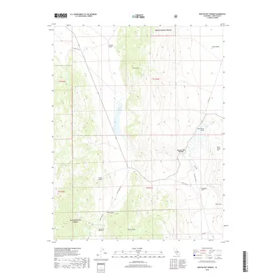
2018 Map of Benton Hot Springs
USGS Topo · Published 2018About this map
Benton Hot Springs serves as the focal point for this Mono County landscape, situated where the high desert terrain of the Benton Range meets the agricultural expanse of Benton Valley. The geography is defined by significant elevation changes, from the heights of Trafton Mtn and the ridges within the Inyo National Forest down to the basin of Black Lake. The area's water sources and drainage patterns are mapped in detail, showing a network of canyons and gulches like Klondike Canyon and Comanche Gulch that carve through the arid hills.
Find a feature on this map
24 named features on this map. Tap any name to fly to it.
Don’t see what you’re looking for? This feature index may not catch every label — zoom into the map to look around manually.
Map Details
Editions of this 2018 Benton Hot Springs Map
This is the sole edition of this map. No revisions or reprints were ever made.
Other maps of this area

1914 · Mt. Morrison
USGS Topo · 1:125,000

1917 · White Mountain
USGS Topo · 1:125,000

1947 · Mariposa
USGS Topo · 1:250,000

1948 · Mariposa
USGS Topo · 1:250,000

1953 · Casa Diablo Mtn
USGS Topo · 1:62,500

1957 · Mariposa
USGS Topo · 1:250,000

1962 · Benton
USGS Topo · 1:62,500

1962 · Glass Mountain
USGS Topo · 1:62,500

1962 · White Mtn. Peak
USGS Topo · 1:62,500

1963 · Mariposa
USGS Topo · 1:250,000