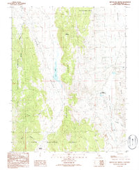
1986 Map of Benton Hot Springs
USGS Topo · Published 1986About this map
Benton Hot Springs serves as a focal point in this high-desert landscape of eastern California, where the thermal features of the Benton Valley meet the rising slopes of the Benton Range. The map documents a significant industrial footprint through numerous Pumice Quarries and scattered Prospects, particularly along Blind Spring Hill and the surrounding volcanic terrain. To the west, the Adobe Valley provides a stark contrast with its broad expanse and the distinctive Black Lake, while the deeply incised Klondike Canyon and Comanche Gulch define the drainage patterns of the Inyo National Forest. Local history is preserved in small details like the Cem near the hot springs and the secluded Watterson Meadow to the south, highlighting the small-scale settlement and ranching that persisted alongside the region's mining interests.
Find a feature on this map
34 named features on this map. Tap any name to fly to it.
Don’t see what you’re looking for? This feature index may not catch every label — zoom into the map to look around manually.
Map Details
Editions of this 1986 Benton Hot Springs Map
This is the sole edition of this map. No revisions or reprints were ever made.
Other maps of this area

1914 · Mt. Morrison
USGS Topo · 1:125,000

1917 · White Mountain
USGS Topo · 1:125,000

1947 · Mariposa
USGS Topo · 1:250,000

1948 · Mariposa
USGS Topo · 1:250,000

1953 · Casa Diablo Mtn
USGS Topo · 1:62,500

1957 · Mariposa
USGS Topo · 1:250,000

1962 · Benton
USGS Topo · 1:62,500

1962 · Glass Mountain
USGS Topo · 1:62,500

1962 · White Mtn. Peak
USGS Topo · 1:62,500

1963 · Mariposa
USGS Topo · 1:250,000