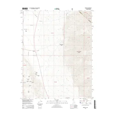
2015 Map of Benton
USGS Topo · Published 2015About this map
Benton and the neighboring Montgomery City sit at the western edge of the White Mountains along the border of California and Nevada. This high-desert landscape is defined by its deep drainages and volcanic peaks, with Blind Spring Hill and the summits of Modoc Peak, Pearce Peak, and Diana Peak rising above the valley floor. The map documents an intricate network of ranch roads and gulches that speak to the area's agricultural and prospecting history, including named features such as Last Chance Gulch, Comanche Gulch, and Barasco Gulch. Much of the eastern terrain transitions into the Inyo National Forest, where the topography steepens significantly. Water sources are scarce but critical, marked here by the seasonal flows of Montgomery Cr, Marble Cr, and Morris Cr as they descend from the high peaks toward the Benton Valley.
Find a feature on this map
41 named features on this map. Tap any name to fly to it.
Don’t see what you’re looking for? This feature index may not catch every label — zoom into the map to look around manually.
Map Details
Editions of this 2015 Benton Map
This is the sole edition of this map. No revisions or reprints were ever made.
Other maps of this area

1914 · Mt. Morrison
USGS Topo · 1:125,000

1917 · White Mountain
USGS Topo · 1:125,000

1947 · Mariposa
USGS Topo · 1:250,000

1948 · Mariposa
USGS Topo · 1:250,000

1953 · Casa Diablo Mtn
USGS Topo · 1:62,500

1957 · Mariposa
USGS Topo · 1:250,000

1962 · Benton
USGS Topo · 1:62,500

1962 · Glass Mountain
USGS Topo · 1:62,500

1962 · White Mtn. Peak
USGS Topo · 1:62,500

1963 · Mariposa
USGS Topo · 1:250,000