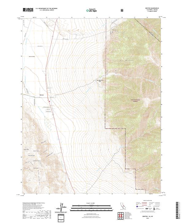
2021 Map of Benton
USGS Topo · Published 2021About this map
Benton Valley serves as a prominent basin where the eastern edge of the White Mountains meets the high desert floor. The small community of Benton is the central hub, situated near the intersection of various ranch roads like Clark Ranch Rd and Reichart Ranch Rd. The landscape is dominated by the steep ascent into the Inyo National Forest to the east, while to the west, Blind Spring Hill rises above the valley floor. To the north, Montgomery City sits along the banks of Montgomery Cr, reflecting the area's history of high-altitude settlement. The topography is defined by numerous drainage systems, including Barasco Gulch, Last Chance Gulch, and Diana Gulch, which carve through the peaks of the southern range. Peaks such as Anderson Peak, Pearce Peak, and Diana Peak provide a dramatic backdrop to the dispersed ranching and mining-related names that dot the terrain.
Find a feature on this map
44 named features on this map. Tap any name to fly to it.
Don’t see what you’re looking for? This feature index may not catch every label — zoom into the map to look around manually.
Map Details
Editions of this 2021 Benton Map
This is the sole edition of this map. No revisions or reprints were ever made.
Other maps of this area

1914 · Mt. Morrison
USGS Topo · 1:125,000

1917 · White Mountain
USGS Topo · 1:125,000

1947 · Mariposa
USGS Topo · 1:250,000

1948 · Mariposa
USGS Topo · 1:250,000

1953 · Casa Diablo Mtn
USGS Topo · 1:62,500

1957 · Mariposa
USGS Topo · 1:250,000

1962 · Benton
USGS Topo · 1:62,500

1962 · Glass Mountain
USGS Topo · 1:62,500

1962 · White Mtn. Peak
USGS Topo · 1:62,500

1963 · Mariposa
USGS Topo · 1:250,000