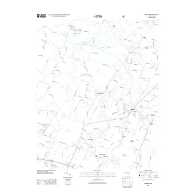
2013 Map of Benton
USGS Topo · Published 2013About this map
The Ocoee River and Hiwassee River converge in this Tennessee valley, defining a landscape of sharp river bends and rich bottomlands. The settlement of Benton serves as the focal point, situated south of the Ocoee, while Benton Station lies to the northwest, indicating the historical influence of rail and river transit on local development. Numerous river features like Coon Denton Island, Workman Island, and the McClary Islands suggest a complex riparian environment that has long shaped agricultural and transportation patterns in the region.
Find a feature on this map
186 named features on this map. Tap any name to fly to it.
Don’t see what you’re looking for? This feature index may not catch every label — zoom into the map to look around manually.
Map Details
Editions of this 2013 Benton Map
This is the sole edition of this map. No revisions or reprints were ever made.
Other maps of this area

1886 · Cleveland
USGS Topo · 1:125,000

1892 · Cleveland
USGS Topo · 1:125,000

1895 · Cleveland
USGS Topo · 1:125,000

1901 · Cleveland
USGS Topo · 1:125,000

1935 · East Cleveland
USGS Topo · 1:24,000

1935 · Calhoun
USGS Topo · 1:24,000

1935 · Benton
USGS Topo · 1:24,000

1935 · Felker
USGS Topo · 1:24,000

1935 · Charleston
USGS Topo · 1:24,000
1935 · Parksville
USGS Topo · 1:24,000