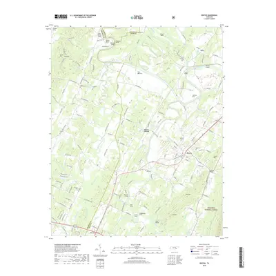
2019 Map of Benton
USGS Topo · Published 2019About this map
Benton serves as the focal point of this landscape, situated near the confluence of several significant waterways. The Hiwassee River winds through the northern portion of the region, creating distinct geographical features such as Smoky Bend, Pinhook Bend, and Osment Bend. The river valley is dotted with named landforms like Boyd Bottoms and Guinn Island, illustrating a long history of river-dependent settlement and agriculture. To the south, the Ocoee River flows near the community of Ocoee, where the terrain begins to rise toward the Cherokee National Forest.
Find a feature on this map
180 named features on this map. Tap any name to fly to it.
Don’t see what you’re looking for? This feature index may not catch every label — zoom into the map to look around manually.
Map Details
Editions of this 2019 Benton Map
This is the sole edition of this map. No revisions or reprints were ever made.
Other maps of this area

1886 · Cleveland
USGS Topo · 1:125,000

1892 · Cleveland
USGS Topo · 1:125,000

1895 · Cleveland
USGS Topo · 1:125,000

1901 · Cleveland
USGS Topo · 1:125,000

1935 · East Cleveland
USGS Topo · 1:24,000

1935 · Calhoun
USGS Topo · 1:24,000

1935 · Benton
USGS Topo · 1:24,000

1935 · Felker
USGS Topo · 1:24,000

1935 · Charleston
USGS Topo · 1:24,000
1935 · Parksville
USGS Topo · 1:24,000