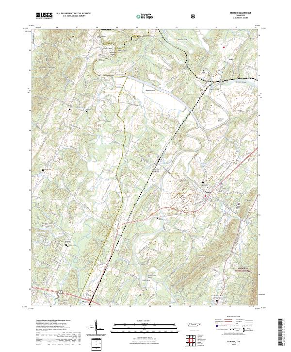
2022 Map of Benton
USGS Topo · Published 2022About this map
The Hiwassee River and Ocoee River define the winding geography of this section of Polk Co and Mcminn Co counties. The settlement of Benton serves as a central hub, while the surrounding landscape is marked by prominent river features like Boyd Bottoms, Coon Denton Island, and Hildebrand Bend. Significant genealogical and historical sites are found throughout the valley, including the Chestuee Methodist Church Cem and the Nancy Ward Cem, the latter of which honors the influential Cherokee leader near the river banks.
Find a feature on this map
166 named features on this map. Tap any name to fly to it.
Don’t see what you’re looking for? This feature index may not catch every label — zoom into the map to look around manually.
Map Details
Editions of this 2022 Benton Map
This is the sole edition of this map. No revisions or reprints were ever made.
Other maps of this area

1886 · Cleveland
USGS Topo · 1:125,000

1892 · Cleveland
USGS Topo · 1:125,000

1895 · Cleveland
USGS Topo · 1:125,000

1901 · Cleveland
USGS Topo · 1:125,000

1935 · East Cleveland
USGS Topo · 1:24,000

1935 · Calhoun
USGS Topo · 1:24,000

1935 · Benton
USGS Topo · 1:24,000

1935 · Felker
USGS Topo · 1:24,000

1935 · Charleston
USGS Topo · 1:24,000
1935 · Parksville
USGS Topo · 1:24,000