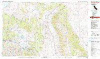
1988 Map of Benton Range
USGS Topo · Published 1988About this map
Benton Hot Springs and the historic site of Montgomery City anchor the eastern slopes of the Benton Range in this late 1980s landscape. The map details a high-desert environment where water dictates human settlement, from the River Spring Lakes in the north to the Whitmore Hot Springs near Lake Crowley in the west. Mining history is evident through scattered operations like the Black Warrior Mine and Queen Canyon Mine, reflecting decades of extraction in the White Mountains.
Find a feature on this map
86 named features on this map. Tap any name to fly to it.
Don’t see what you’re looking for? This feature index may not catch every label — zoom into the map to look around manually.
Map Details
Editions of this 1988 Benton Range Map
2 editions found
Other maps of this area

1898 · Silver Peak
USGS Topo · 1:125,000

1900 · Silver Peak
USGS Topo · 1:125,000

1901 · Mt. Lyell
USGS Topo · 1:125,000

1904 · Kaiser
USGS Topo · 1:125,000

1907 · Tonopah
USGS Topo · 1:250,000

1908 · Lida
USGS Topo · 1:250,000

1908 · Tonopah
USGS Topo · 1:250,000

1909 · Hawthorne
USGS Topo · 1:250,000

1909 · Bridgeport
USGS Topo · 1:125,000

1911 · Bridgeport
USGS Topo · 1:125,000