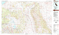
1988 Map of Benton Range
USGS Topo · Published 1988About this map
The Benton Range and the high desert valleys of the California-Nevada border define this landscape of mining activity and thermal springs. In the eastern portion of the map, the White Mountains rise toward Boundary Peak, the highest point in Nevada, while the Sierra Nevada dominates the west. Settlement patterns here are dictated by water and mineral wealth, from the recreational hubs of Mammoth Lakes and Old Mammoth to the secluded Benton Hot Springs.
Find a feature on this map
85 named features on this map. Tap any name to fly to it.
Don’t see what you’re looking for? This feature index may not catch every label — zoom into the map to look around manually.
Map Details
Editions of this 1988 Benton Range Map
2 editions found
Other maps of this area

1898 · Silver Peak
USGS Topo · 1:125,000

1900 · Silver Peak
USGS Topo · 1:125,000

1901 · Mt. Lyell
USGS Topo · 1:125,000

1904 · Kaiser
USGS Topo · 1:125,000

1907 · Tonopah
USGS Topo · 1:250,000

1908 · Lida
USGS Topo · 1:250,000

1908 · Tonopah
USGS Topo · 1:250,000

1909 · Hawthorne
USGS Topo · 1:250,000

1909 · Bridgeport
USGS Topo · 1:125,000

1911 · Bridgeport
USGS Topo · 1:125,000