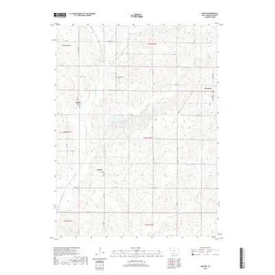
2018 Map of Benton
USGS Topo · Published 2018About this map
Benton and Delphos anchor this rural landscape in southwestern Iowa, where the terrain is deeply etched by the winding course of the Grand River. The area is characterized by a dense network of country roads following the section lines of the Public Land Survey System, revealing the enduring agrarian layout of Ringgold County. Small settlements like Marshalltown and the western edge of Mount Ayr are connected by a grid of named thoroughfares such as 240th St and 190th Ave.
Find a feature on this map
41 named features on this map. Tap any name to fly to it.
Don’t see what you’re looking for? This feature index may not catch every label — zoom into the map to look around manually.
Map Details
Editions of this 2018 Benton Map
This is the sole edition of this map. No revisions or reprints were ever made.
Other maps of this area

1940 · Blockton
USGS Topo · 1:62,500

1943 · Blockton
USGS Topo · 1:62,500

1945 · Mount Ayr
USGS Topo · 1:62,500

1947 · Mount Ayr
USGS Topo · 1:62,500

1955 · Nebraska City
USGS Topo · 1:250,000

1957 · Nebraska City
USGS Topo · 1:250,000

1958 · Nebraska City
USGS Topo · 1:250,000
1981 · Blockton SE
USGS Topo · 1:24,000
1981 · Diagonal
USGS Topo · 1:24,000
1981 · Maloy
USGS Topo · 1:24,000