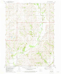
1981 Map of Maloy
USGS Topo · Published 1981About this map
Maloy serves as the primary hub of this rural Ringgold County landscape, situated where the Chicago and North Western railroad cuts a diagonal path across the rolling terrain. The area is defined by its watercourses, most notably the winding Platte River and the Turkey Creek drainage, which dictate the placement of local roads and farmsteads. Cultural markers are concentrated around the village and along the township lines, with several established burial grounds including Platte River Cem and St Marys Cem located nearby. The survey reveals a late-twentieth-century rural economy still tied closely to the land and the rail line, with townships like Waubonsie and Benton showing a traditional grid of section lines that organize the agricultural space between the river valleys.
Find a feature on this map
15 named features on this map. Tap any name to fly to it.
Don’t see what you’re looking for? This feature index may not catch every label — zoom into the map to look around manually.
Map Details
Editions of this 1981 Maloy Map
This is the sole edition of this map. No revisions or reprints were ever made.
Other maps of this area

1940 · Blockton
USGS Topo · 1:62,500

1940 · Bedford
USGS Topo · 1:62,500

1943 · Bedford
USGS Topo · 1:62,500

1943 · Blockton
USGS Topo · 1:62,500

1955 · Nebraska City
USGS Topo · 1:250,000

1957 · Nebraska City
USGS Topo · 1:250,000

1958 · Nebraska City
USGS Topo · 1:250,000

1980 · Merle Junction
USGS Topo · 1:24,000
1980 · Conway
USGS Topo · 1:24,000
1980 · Sheridan
USGS Topo · 1:24,000