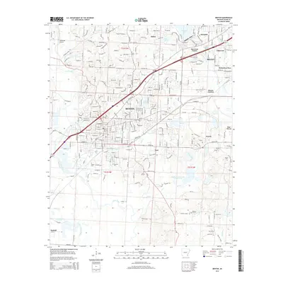
2014 Map of Benton
USGS Topo · Published 2014About this map
Benton and Bryant anchor this landscape during a period of sustained suburban and industrial integration in Saline County. The map documents a complex network of residential developments such as Sherwood Estates and Edgewood emerging alongside established industrial sites. The southern portion of the sheet is dominated by the legacy of local mining, marked by the Bauxite & Northern RR and the Alcoa Water Supply. The terrain transitions from the elevations of Silica Heights toward the Saline River and its numerous tributaries, including Holly Cr and Dodson Creek. Genealogists will find a significant distribution of local burial grounds, ranging from Bauxite Cem near the aluminum works to the smaller Scott Cem and McPherson Cem tucked into the northern townships.
Find a feature on this map
262 named features on this map. Tap any name to fly to it.
Don’t see what you’re looking for? This feature index may not catch every label — zoom into the map to look around manually.
Map Details
Editions of this 2014 Benton Map
This is the sole edition of this map. No revisions or reprints were ever made.
Other maps of this area

1890 · Benton
USGS Topo · 1:125,000

1891 · Little Rock
USGS Topo · 1:125,000

1893 · Little Rock
USGS Topo · 1:125,000

1894 · Benton
USGS Topo · 1:125,000

1935 · Alexander
USGS Topo · 1:48,000

1938 · Benton
USGS Topo · 1:48,000

1941 · Alexander
USGS Topo · 1:62,500

1944 · Benton
USGS Topo · 1:62,500

1944 · Alexander
USGS Topo · 1:31,680

1944 · Bryant
USGS Topo · 1:31,680