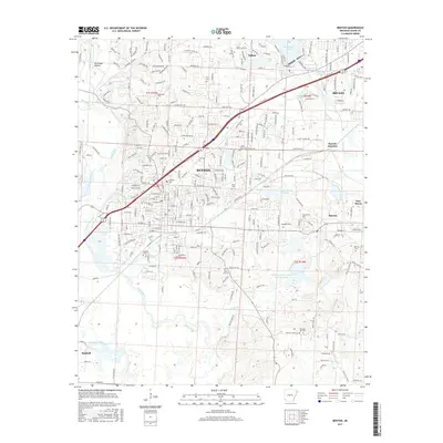
2017 Map of Benton
USGS Topo · Published 2017About this map
Benton serves as the central hub of this Saline County landscape, where the Saline River and its various tributaries like Salt Creek and McNeil Creek carve through the terrain. The map documents a significant industrial and resource-based footprint, notably the Alcoa Water Supply and the namesake town of Bauxite, reflecting the region's historical ties to aluminum ore mining. This industrial character is further evidenced by landmarks such as Bauxite Junction and the numerous holding ponds scattered across the township lines of t2s r14w and t2s r15w.
Find a feature on this map
276 named features on this map. Tap any name to fly to it.
Don’t see what you’re looking for? This feature index may not catch every label — zoom into the map to look around manually.
Map Details
Editions of this 2017 Benton Map
This is the sole edition of this map. No revisions or reprints were ever made.
Other maps of this area

1890 · Benton
USGS Topo · 1:125,000

1891 · Little Rock
USGS Topo · 1:125,000

1893 · Little Rock
USGS Topo · 1:125,000

1894 · Benton
USGS Topo · 1:125,000

1935 · Alexander
USGS Topo · 1:48,000

1938 · Benton
USGS Topo · 1:48,000

1941 · Alexander
USGS Topo · 1:62,500

1944 · Benton
USGS Topo · 1:62,500

1944 · Alexander
USGS Topo · 1:31,680

1944 · Bryant
USGS Topo · 1:31,680