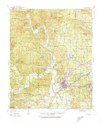
1938 Map of Benton
USGS Topo · Published 1974About this map
Benton serves as the focal point of this late 1930s landscape, positioned where the Missouri Pacific railroad intersects the North Fork Saline River. The region's economy is clearly defined by its geology, most notably at the Bauxite Mines and the company town of Bauxite, which are supported by the dedicated Bauxite & Northern rail line. This era captures a rural network of river crossings and small community centers, including numerous river fords such as Wray Ford and Will James Ford.
Find a feature on this map
84 named features on this map. Tap any name to fly to it.
Don’t see what you’re looking for? This feature index may not catch every label — zoom into the map to look around manually.
Map Details
Editions of this 1938 Benton Map
4 editions found
Other maps of this area

1890 · Benton
USGS Topo · 1:125,000

1891 · Little Rock
USGS Topo · 1:125,000

1893 · Little Rock
USGS Topo · 1:125,000

1894 · Benton
USGS Topo · 1:125,000

1935 · Alexander
USGS Topo · 1:48,000

1938 · Benton
USGS Topo · 1:48,000

1941 · Alexander
USGS Topo · 1:62,500

1943 · Pinnacle Mtn
USGS Topo · 1:31,680

1944 · Benton
USGS Topo · 1:62,500

1944 · Alexander
USGS Topo · 1:31,680