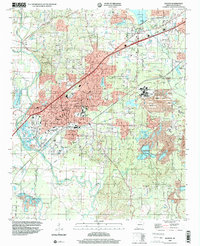
1994 Map of Benton
USGS Topo · Published 2000About this map
The Saline River winds through the southwestern reaches of this survey, serving as a geographic anchor for the city of Benton. The landscape during the mid-1990s reflects a complex mix of municipal expansion and industrial legacy, particularly evident in the extensive Tailings Ponds and mining infrastructure near Bauxite. This area, once the heart of the world's aluminum ore production, is shown here with its specialized rail spurs like the McNeil line and the proximity of the Bauxite Junction.
Find a feature on this map
74 named features on this map. Tap any name to fly to it.
Don’t see what you’re looking for? This feature index may not catch every label — zoom into the map to look around manually.
Map Details
Editions of this 1994 Benton Map
This is the sole edition of this map. No revisions or reprints were ever made.
Other maps of this area

1890 · Benton
USGS Topo · 1:125,000

1891 · Little Rock
USGS Topo · 1:125,000

1893 · Little Rock
USGS Topo · 1:125,000

1894 · Benton
USGS Topo · 1:125,000

1935 · Alexander
USGS Topo · 1:48,000

1938 · Benton
USGS Topo · 1:48,000

1941 · Alexander
USGS Topo · 1:62,500

1944 · Benton
USGS Topo · 1:62,500

1944 · Alexander
USGS Topo · 1:31,680

1944 · Bryant
USGS Topo · 1:31,680