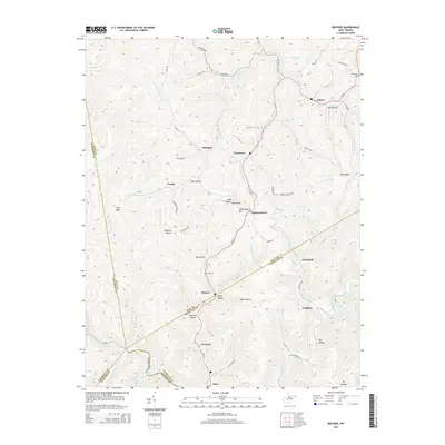
2014 Map of Bentree
USGS Topo · Published 2014About this map
Bentree and Vaughan serve as central points in this portrait of a landscape defined by its deep drainages and rural settlements. The terrain is a complex network of hollows and ridges, with family and local history anchored by the Ida Cem and Holcomb Cem. Significant watercourses like Twentymile Creek, Sagamore Fork, and Rockcamp Fork carve through the land, dictating the placement of roads such as WV-16 and Lizemore Rd.
Find a feature on this map
58 named features on this map. Tap any name to fly to it.
Don’t see what you’re looking for? This feature index may not catch every label — zoom into the map to look around manually.
Map Details
Editions of this 2014 Bentree Map
This is the sole edition of this map. No revisions or reprints were ever made.
Other maps of this area

1897 · Kanawha Falls
USGS Topo · 1:125,000

1900 · Kanawha Falls
USGS Topo · 1:125,000

1901 · Kanawha Falls
USGS Topo · 1:125,000

1907 · Clendenin
USGS Topo · 1:62,500

1908 · Clay
USGS Topo · 1:48,000

1908 · Fayetteville
USGS Topo · 1:48,000

1908 · Montgomery
USGS Topo · 1:48,000

1909 · Clendenin
USGS Topo · 1:62,500

1910 · Clay
USGS Topo · 1:62,500

1910 · Fayetteville
USGS Topo · 1:62,500