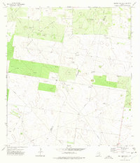
1972 Map of Bentsen Ranch
USGS Topo · Published 1975About this map
El Benadito and the surrounding South Texas brushland define this 1970s landscape, where cattle ranching and energy extraction exist side-by-side. The presence of the Bentsen Ranch and a remote Landing Field suggests the large-scale operations typical of the region, while the surveyor's notes of an Indefinite Boundary along the Starr Co Hidalgo Co line reflect the complexities of mapping this terrain.
Find a feature on this map
34 named features on this map. Tap any name to fly to it.
Don’t see what you’re looking for? This feature index may not catch every label — zoom into the map to look around manually.
Map Details
Editions of this 1972 Bentsen Ranch Map
2 editions found
Other maps of this area

1938 · Sal Colorada
USGS Topo · 1:62,500

1939 · La Reforma
USGS Topo · 1:62,500

1940 · Monte Christo
USGS Topo · 1:62,500

1949 · Mc Allen
USGS Topo · 1:250,000

1954 · McAllen
USGS Topo · 1:250,000

1956 · Garcias
USGS Topo · 1:62,500

1957 · Mc Allen
USGS Topo · 1:250,000

1962 · McAllen
USGS Topo · 1:250,000

1963 · Monte Christo
USGS Topo · 1:24,000
1963 · McCook
USGS Topo · 1:24,000