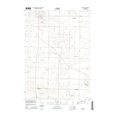
2014 Map of Benzonia
USGS Topo · Published 2014About this map
Benzonia and Beulah serve as the primary hubs in this Benzie County landscape, situated where the terrain begins its descent toward the water. The Betsie River snakes through the central portion of the map, defining the local drainage alongside smaller tributaries like Rice Cr and Cold Cr. This 2014 survey documents a mix of agricultural layout and recreation, notably at Crystal Mountain in the southeast corner near the Buck Hills. Genealogists will find the Benzonia Township Cem and Joyfield Cem clearly marked, providing spatial context for local families. The presence of the Beulah-Benzonia Sewage Disposal Ponds and a network of named county roads, such as Homestead Rd and Grace Rd, illustrates the modern infrastructure supporting these longstanding Northern Michigan communities.
Find a feature on this map
89 named features on this map. Tap any name to fly to it.
Don’t see what you’re looking for? This feature index may not catch every label — zoom into the map to look around manually.
Map Details
Editions of this 2014 Benzonia Map
This is the sole edition of this map. No revisions or reprints were ever made.
Other maps of this area

1954 · Traverse City
USGS Topo · 1:250,000

1954 · Manitowoc
USGS Topo · 1:250,000

1956 · Onekama
USGS Topo · 1:62,500

1956 · Thompsonville
USGS Topo · 1:62,500

1956 · Frankfort
USGS Topo · 1:62,500

1957 · Copemish
USGS Topo · 1:62,500

1958 · Traverse City
USGS Topo · 1:250,000

1958 · Manitowoc
USGS Topo · 1:250,000

1976 · Frankfort SE
USGS Topo · 1:24,000

1976 · Frankfort NW
USGS Topo · 1:24,000