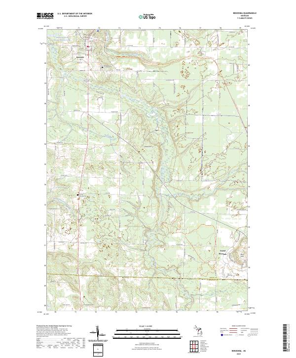
2023 Map of Benzonia
USGS Topo · Published 2023About this map
Benzonia serves as the central hub of this northern Michigan landscape, where the Betsie River and its numerous tributaries like Cold Creek and Rice Creek carve through the terrain. The presence of the Benzonia Township Cem and Joyfield Township Cem offers specific points of interest for genealogists tracing local families in this part of Benzie County. The map captures a sophisticated network of trails and secondary roads, including the Betsie Valley State Trl and the Betsie River Trl, which follow the natural contours of the valley. To the southeast, the elevation rises toward the Buck Hills and the developments at Crystal Mountain, reflecting the area's modern identity as a center for outdoor recreation. The infrastructure is further defined by rural corridors such as King Rd and Joyfield Rd, connecting the scattered settlements and agricultural lands north of the Benzie Co Manistee Co line.
Find a feature on this map
54 named features on this map. Tap any name to fly to it.
Don’t see what you’re looking for? This feature index may not catch every label — zoom into the map to look around manually.
Map Details
Editions of this 2023 Benzonia Map
This is the sole edition of this map. No revisions or reprints were ever made.
Other maps of this area

1954 · Traverse City
USGS Topo · 1:250,000

1954 · Manitowoc
USGS Topo · 1:250,000

1956 · Onekama
USGS Topo · 1:62,500

1956 · Thompsonville
USGS Topo · 1:62,500

1956 · Frankfort
USGS Topo · 1:62,500

1957 · Copemish
USGS Topo · 1:62,500

1958 · Traverse City
USGS Topo · 1:250,000

1958 · Manitowoc
USGS Topo · 1:250,000

1976 · Frankfort SE
USGS Topo · 1:24,000

1976 · Frankfort NW
USGS Topo · 1:24,000