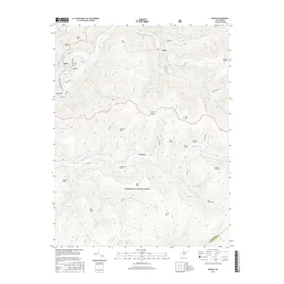
2016 Map of Bergoo
USGS Topo · Published 2016About this map
Bergoo and Jerryville sit within a heavily dissected landscape defined by the drainage systems of the Elk River and Gauley River. This high-relief terrain in Webster County is marked by prominent ridges such as Point Mtn and the Gauley Divide, which separates the northern and southern watersheds. Small settlements like Curtin and Ralph are tucked into narrow valley corridors, reflecting the region's historical reliance on river-bottom sites for development. A significant portion of the southern area is preserved within the Monongahela National Forest, where the topography rises into the Yew Mountains. For local historians and genealogists, the map identifies key landmarks including Union Cem near Curtin, the Meadowland Cem near Bergoo, and the uniquely named Gwen Wyatt Spring located along the upper reaches of the Elk River.
Find a feature on this map
63 named features on this map. Tap any name to fly to it.
Don’t see what you’re looking for? This feature index may not catch every label — zoom into the map to look around manually.
Map Details
Editions of this 2016 Bergoo Map
This is the sole edition of this map. No revisions or reprints were ever made.
Other maps of this area

1891 · Huntersville
USGS Topo · 1:125,000

1893 · Buckhannon
USGS Topo · 1:125,000

1894 · Huntersville
USGS Topo · 1:125,000

1896 · Buckhannon
USGS Topo · 1:125,000

1897 · Buckhannon
USGS Topo · 1:125,000

1913 · Hacker Valley
USGS Topo · 1:48,000

1913 · Pickens
USGS Topo · 1:48,000

1915 · Webster Springs
USGS Topo · 1:48,000

1915 · Hacker Valley
USGS Topo · 1:62,500

1915 · Pickens
USGS Topo · 1:62,500