
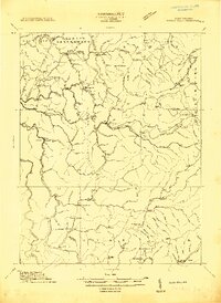
1913 Map of Hacker Valley
USGS Topo · Published 1913About this map
Salt Lick Settlement and the small village of Hacker Valley anchor this 1913 topography of the Allegheny Highlands, where the headwaters of several major drainages diverge. The complex river system is defined by the Little Kanawha River to the north and the Elk River to the south, with the Holly River carving deep valleys through the center of the sheet. This map captures the pre-industrial character of the region, emphasizing isolated mountain communities like Cleveland, Wildcat, and Arvondale that were connected by narrow trails and creek-bottom roads before modern highway development.
Find a feature on this map
33 named features on this map. Tap any name to fly to it.
Don’t see what you’re looking for? This feature index may not catch every label — zoom into the map to look around manually.
Map Details
Editions of this 1913 Hacker Valley Map
2 editions found
Other maps of this area

1889 · Nicholas
USGS Topo · 1:125,000

1891 · Nicholas
USGS Topo · 1:125,000

1891 · Huntersville
USGS Topo · 1:125,000

1893 · Buckhannon
USGS Topo · 1:125,000

1893 · Sutton
USGS Topo · 1:125,000

1894 · Huntersville
USGS Topo · 1:125,000

1896 · Buckhannon
USGS Topo · 1:125,000

1897 · Buckhannon
USGS Topo · 1:125,000

1901 · Nicholas
USGS Topo · 1:125,000

1906 · Burnsville
USGS Topo · 1:62,500