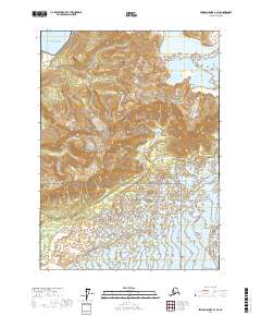
2017 Map of Bering Glacier A-1 SE
USGS Topo · Published 2017About this map
Wrangéll-Saint Elias National Park dominates this glacial landscape on the edge of the Gulf of Alaska. The terrain is defined by the massive reach of the Agassiz Glacier, which feeds into the Agassiz Lakes and influences the drainage patterns of the Caetani River to the south. This coastal region is characterized by extreme topographic shifts, from the sea-level shoreline to the prominent elevations of the Chaix Hills. The map details the complex ice-and-water systems of the Yakutat City and Borough area, documenting the positions of active glacial margins and braided river channels as they appeared in 2017. These features represent a highly dynamic environment where shifting ice and sediment continuously reshape the coastal wilderness.
Find a feature on this map
10 named features on this map. Tap any name to fly to it.
Don’t see what you’re looking for? This feature index may not catch every label — zoom into the map to look around manually.
Map Details
Editions of this 2017 Bering Glacier A-1 SE Map
This is the sole edition of this map. No revisions or reprints were ever made.
Other maps of this area

1950 · Bering Glacier
USGS Topo · 1:250,000

1950 · Icy Bay
USGS Topo · 1:250,000

1951 · Icy Bay
USGS Topo · 1:250,000

1951 · Bering Glacier
USGS Topo · 1:250,000

1951 · Yakutat
USGS Topo · 1:250,000

1951 · Mt Saint Elias
USGS Topo · 1:250,000

1959 · Yakutat
USGS Topo · 1:250,000

1959 · Bering Glacier
USGS Topo · 1:250,000

1959 · Mt Saint Elias
USGS Topo · 1:250,000

1961 · Icy Bay
USGS Topo · 1:250,000