
2017 Map of Bering Glacier A-2 SE
USGS Topo · Published 2017About this map
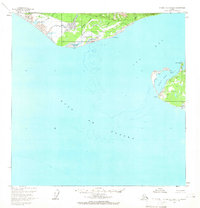
Wrangell-Saint Elias National Park dominates the southern half of this coastal survey, where steep glacial terrain meets the tidewaters of the North Pacific. The landscape is defined by its deep inlets and glacial drainage systems, most notably Tsaa Fiord and the eastern reaches of Icy Bay. In the northern section, the Alaska Maritime National Wildlife Refuge encompasses the Guyot Hills, a prominent landform situated between the coastal waters and the interior wilderness. Freshwater drainage is represented by coastal streams such as Independence Cr and Carson Cr, which carve through the high-elevation contours before reaching the Gulf of Alaska. This document illustrates the intersection of two major federal conservation areas in a region where the geography is constantly reshaped by maritime influence and glacial activity.
Find a feature on this map
11 named features on this map. Tap any name to fly to it.
Don’t see what you’re looking for? This feature index may not catch every label — zoom into the map to look around manually.
Map Details
Editions of this 2017 Bering Glacier A-2 SE Map
This is the sole edition of this map. No revisions or reprints were ever made.
Other maps of this area

1948 · Icy Bay D-2 and D-3
USGS Topo · 1:63,360

1950 · Bering Glacier
USGS Topo · 1:250,000

1950 · Icy Bay
USGS Topo · 1:250,000

1951 · Icy Bay D-2 and D-3
USGS Topo · 1:63,360

1951 · Icy Bay
USGS Topo · 1:250,000

1951 · Bering Glacier
USGS Topo · 1:250,000

1951 · Bering Glacier A-2
USGS Topo · 1:63,360
1959 · Icy Bay D-2 and D-3
USGS Topo · 1:63,360

1959 · Bering Glacier
USGS Topo · 1:250,000

1959 · Bering Glacier A-2
USGS Topo · 1:63,360