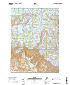
2017 Map of Bering Glacier A-2 SW
USGS Topo · Published 2017About this map
Wrangell-Saint Elias National Park encompasses the majority of this landscape, characterized by the dramatic elevation changes of the Robinson Mountains. This 2017 survey illustrates a terrain defined by glacial activity and a network of drainage systems, including the notable Beare Glacier which feeds into the lower-lying waterways. The hydrological structure of the region is traced through several named streams such as Crystal Cr, Big Sandy Cr, and Watson Cr, alongside the Priest River. These features provide a clear picture of the remote wilderness and the complex watershed within this protected Alaskan territory. The absence of roads or permanent settlements in this quadrangle reflects its status as a preserved natural environment, where the topography is dictated by ice and high-altitude peaks.
Find a feature on this map
11 named features on this map. Tap any name to fly to it.
Don’t see what you’re looking for? This feature index may not catch every label — zoom into the map to look around manually.
Map Details
Editions of this 2017 Bering Glacier A-2 SW Map
This is the sole edition of this map. No revisions or reprints were ever made.
Other maps of this area

1948 · Icy Bay D-2 and D-3
USGS Topo · 1:63,360

1950 · Bering Glacier A-3
USGS Topo · 1:63,360

1950 · Bering Glacier
USGS Topo · 1:250,000

1950 · Icy Bay
USGS Topo · 1:250,000

1951 · Icy Bay D-2 and D-3
USGS Topo · 1:63,360

1951 · Icy Bay
USGS Topo · 1:250,000

1951 · Bering Glacier
USGS Topo · 1:250,000

1951 · Bering Glacier A-2
USGS Topo · 1:63,360
1959 · Icy Bay D-2 and D-3
USGS Topo · 1:63,360

1959 · Bering Glacier
USGS Topo · 1:250,000