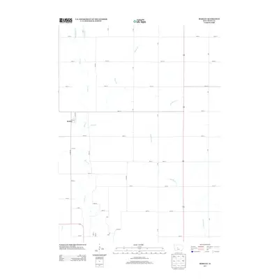
2013 Map of Berkley
USGS Topo · Published 2013About this map
Berkley stands as the primary settlement in this section of Boone County, situated along the western edge of a landscape defined by an intricate drainage system. The area is marked by the convergence of multiple waterways, including Middle Beaver Cr, Beaver Cr, and Little Beaver Cr, which carve through the Iowa plains. The road network follows a strict Jeffersonian grid, with numbered thoroughfares like 280th St and 290th St intersecting named avenues such as Deer Ave and Eagle Ave. This 2013 survey illustrates the modern agricultural footprint of the region, where the natural paths of Beaver Br and Frog Cr provide the only deviation from the geometric precision of the rural section lines.
Find a feature on this map
30 named features on this map. Tap any name to fly to it.
Don’t see what you’re looking for? This feature index may not catch every label — zoom into the map to look around manually.
Map Details
Editions of this 2013 Berkley Map
This is the sole edition of this map. No revisions or reprints were ever made.
Other maps of this area

1911 · Madrid
USGS Topo · 1:62,500

1914 · Madrid
USGS Topo · 1:62,500

1916 · Boone
USGS Topo · 1:62,500

1950 · Perry
USGS Topo · 1:62,500

1951 · Perry
USGS Topo · 1:62,500

1951 · Ogden
USGS Topo · 1:62,500

1954 · Omaha
USGS Topo · 1:250,000

1954 · Waterloo
USGS Topo · 1:250,000

1954 · Fort Dodge
USGS Topo · 1:250,000

1954 · Des Moines
USGS Topo · 1:250,000