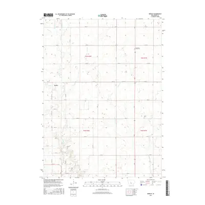
2015 Map of Berkley
USGS Topo · Published 2015About this map
Berkley stands as the primary community in this section of Boone County, situated along a landscape defined by an intricate network of waterways. The drainage pattern is complex, with Beaver Cr and its tributaries, including Middle Beaver Cr, E Beaver Cr, and Beaver Br, carving through the agricultural terrain. The map reveals a high density of small burial grounds that suggest a long-established rural population, including Swede Valley Lutheran Cem and Peoples Cem. These sites, along with Fairview Cem and Moore Cem, provide significant touchstones for genealogical research in the region. The road network follows a strict township and range grid, intersected by smaller creeks like Jim Cr and Frog Cr, illustrating the typical 21st-century Iowan intersection of systematic land division and natural watercourses.
Find a feature on this map
40 named features on this map. Tap any name to fly to it.
Don’t see what you’re looking for? This feature index may not catch every label — zoom into the map to look around manually.
Map Details
Editions of this 2015 Berkley Map
This is the sole edition of this map. No revisions or reprints were ever made.
Other maps of this area

1911 · Madrid
USGS Topo · 1:62,500

1914 · Madrid
USGS Topo · 1:62,500

1916 · Boone
USGS Topo · 1:62,500

1950 · Perry
USGS Topo · 1:62,500

1951 · Perry
USGS Topo · 1:62,500

1951 · Ogden
USGS Topo · 1:62,500

1954 · Omaha
USGS Topo · 1:250,000

1954 · Waterloo
USGS Topo · 1:250,000

1954 · Fort Dodge
USGS Topo · 1:250,000

1954 · Des Moines
USGS Topo · 1:250,000