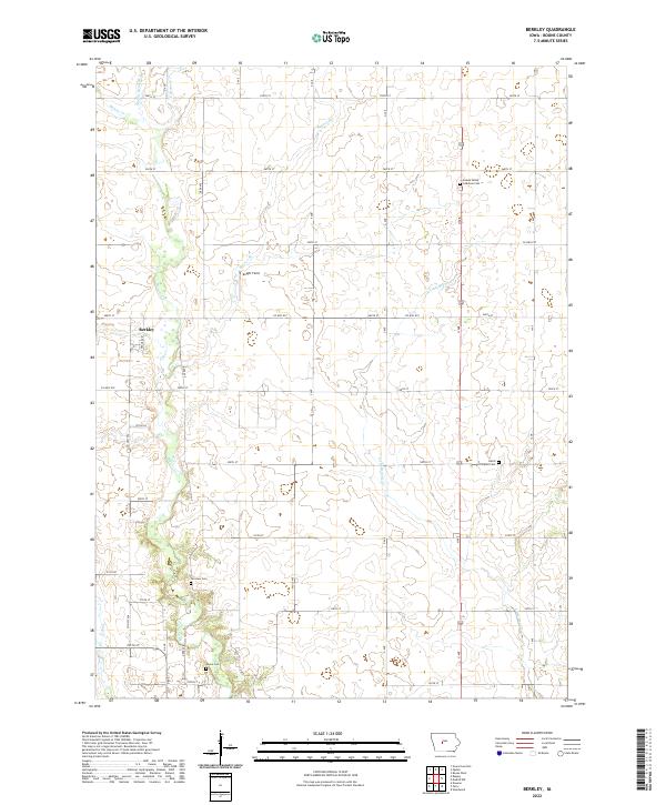
2022 Map of Berkley
USGS Topo · Published 2022About this map
The settlement of Berkley sits within a landscape defined by the branching waters of the Des Moines River basin in Boone County. This agricultural region is meticulously divided by a grid of rural routes, including Co Hwy E57 and numerous numbered streets that navigate the drainage patterns of Beaver Cr and its tributaries. The map reveals a high concentration of burial grounds, such as Swede Valley Lutheran Cem and Fairview Cem, which reflect the area's deep-rooted pioneer and immigrant heritage. These locations, along with Moore Cem and David Peoples Cem, serve as primary markers of the early families who established farms across the townships of T83N R28W and T83N R27W. Local landmarks like Knight Field and the winding course of Little Beaver Cr further characterize this quiet stretch of central Iowa.
Find a feature on this map
31 named features on this map. Tap any name to fly to it.
Don’t see what you’re looking for? This feature index may not catch every label — zoom into the map to look around manually.
Map Details
Editions of this 2022 Berkley Map
This is the sole edition of this map. No revisions or reprints were ever made.
Other maps of this area

1911 · Madrid
USGS Topo · 1:62,500

1914 · Madrid
USGS Topo · 1:62,500

1916 · Boone
USGS Topo · 1:62,500

1950 · Perry
USGS Topo · 1:62,500

1951 · Perry
USGS Topo · 1:62,500

1951 · Ogden
USGS Topo · 1:62,500

1954 · Omaha
USGS Topo · 1:250,000

1954 · Waterloo
USGS Topo · 1:250,000

1954 · Fort Dodge
USGS Topo · 1:250,000

1954 · Des Moines
USGS Topo · 1:250,000