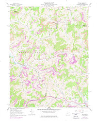
1961 Map of Berlin
USGS Topo · Published 1977About this map
Hackers Creek and the Buckhannon district define the topography of this Lewis County landscape during the early 1960s. The settlement at Berlin serves as a local hub near the confluence of Hackers Creek and Buckhannon Run, while to the south, Lorentz and Fink sit along the Baltimore and Ohio railroad line. The map captures a moment of active resource extraction, with numerous Strip Mine operations and Mines scattered across the ridges, particularly around Bear Knob and the northern hills.
Find a feature on this map
47 named features on this map. Tap any name to fly to it.
Don’t see what you’re looking for? This feature index may not catch every label — zoom into the map to look around manually.
Map Details
Editions of this 1961 Berlin Map
2 editions found
Other maps of this area

1893 · Buckhannon
USGS Topo · 1:125,000

1896 · Buckhannon
USGS Topo · 1:125,000

1897 · Buckhannon
USGS Topo · 1:125,000

1904 · Philippi
USGS Topo · 1:62,500

1904 · Weston
USGS Topo · 1:62,500

1912 · Sago
USGS Topo · 1:48,000

1912 · Crawford
USGS Topo · 1:48,000

1914 · Sago
USGS Topo · 1:62,500

1914 · Crawford
USGS Topo · 1:62,500

1925 · Philippi
USGS Topo · 1:62,500