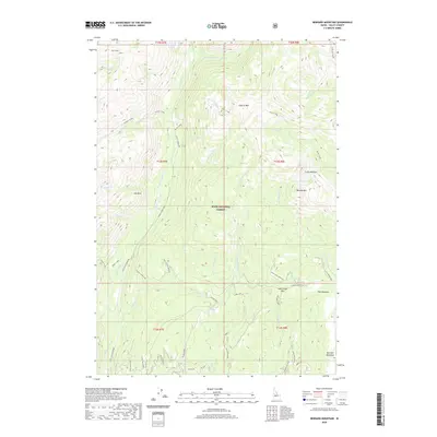
2020 Map of Bernard Mountain
USGS Topo · Published 2020About this map
Boise National Forest encompasses the high country of Valley County, where the Deadwood River and its various forks carve through the mountainous terrain. The landscape is defined by prominent peaks and ridges, including Bernard Mtn and Pilgrim Mtn, with notable geological features like Fin Rock serving as landmarks. The drainage network is dense, with Stratton Cr, Porter Creek, and Bernard Cr feeding into the primary river systems. In the higher elevations, small alpine waters like Bernard Lake and Sheepherder Lake sit near expansive open areas such as Crane Meadow and Bearskin Meadows. This area is accessed by a network of forest routes, including the Stanley-Warm Lake road and the Scott MTN-Deadwood corridor, which follow the natural contours of the river valleys and mountain passes like Deer Creek Pass.
Find a feature on this map
56 named features on this map. Tap any name to fly to it.
Don’t see what you’re looking for? This feature index may not catch every label — zoom into the map to look around manually.
Map Details
Editions of this 2020 Bernard Mountain Map
This is the sole edition of this map. No revisions or reprints were ever made.
Other maps of this area

1891 · Bear Valley
USGS Topo · 1:125,000

1893 · Bear Valley
USGS Topo · 1:125,000

1909 · Garden Valley
USGS Topo · 1:125,000

1953 · Deadwood Reservoir
USGS Topo · 1:62,500

1954 · Warm Lake
USGS Topo · 1:62,500

1957 · Challis
USGS Topo · 1:250,000

1960 · Challis
USGS Topo · 1:250,000

1961 · Chinook Mtn
USGS Topo · 1:62,500

1963 · Challis
USGS Topo · 1:250,000

1972 · Cache Creek
USGS Topo · 1:24,000