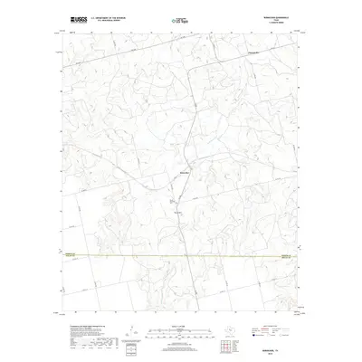
2019 Map of Bernecker
USGS Topo · Published 2019About this map
Claytonville and Bernecker anchor the northern reaches of this West Texas landscape, where the agricultural plains meet the breaks of the Permian Basin. The terrain is defined by the drainage systems of Cottonwood Cr and Linn Cr, which carve through the countryside toward the Fisher and Nolan County line. Near the center of the map, the elevation rises to Round Mtn, a prominent landmark that serves as a sentinel for the nearby Round Mountain Cem.
Find a feature on this map
27 named features on this map. Tap any name to fly to it.
Don’t see what you’re looking for? This feature index may not catch every label — zoom into the map to look around manually.
Map Details
Editions of this 2019 Bernecker Map
This is the sole edition of this map. No revisions or reprints were ever made.
Other maps of this area

1893 · Roby
USGS Topo · 1:125,000

1893 · Sweetwater
USGS Topo · 1:125,000

1954 · Big Spring
USGS Topo · 1:250,000

1958 · Big Spring
USGS Topo · 1:250,000

1969 · Busby
USGS Topo · 1:24,000

1969 · Bull Creek
USGS Topo · 1:24,000

1969 · Inadale NW
USGS Topo · 1:24,000

1969 · Loraine
USGS Topo · 1:24,000

1969 · Bernecker
USGS Topo · 1:24,000

1969 · Roscoe
USGS Topo · 1:24,000