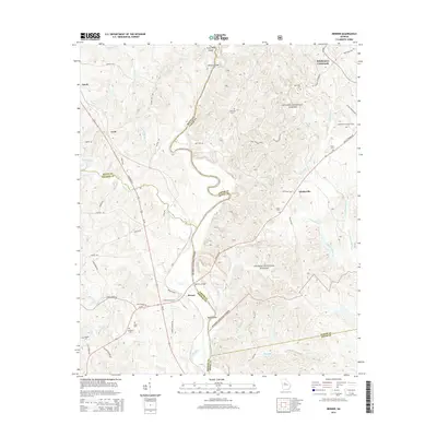
2014 Map of Berner
USGS Topo · Published 2014About this map
The Ocmulgee River and Towaliga River converge in this central Georgia landscape, a region defined by the dense woodlands of the Oconee National Forest and a complex network of creeks. Small agricultural and forest settlements like Berner and Gladesville anchor the local geography, connected by historic routes such as State Rte 83 and Ga-83. Significant family and community history is preserved in several burial grounds, including Enon Cem, Holloway Cem, and New Hope Cem.
Find a feature on this map
76 named features on this map. Tap any name to fly to it.
Don’t see what you’re looking for? This feature index may not catch every label — zoom into the map to look around manually.
Map Details
Editions of this 2014 Berner Map
This is the sole edition of this map. No revisions or reprints were ever made.
Other maps of this area

1951 · Forsyth
USGS Topo · 1:62,500

1953 · Athens
USGS Topo · 1:250,000

1958 · Athens
USGS Topo · 1:250,000

1959 · Athens
USGS Topo · 1:250,000

1963 · Athens
USGS Topo · 1:250,000

1964 · Lloyd Shoals Dam
USGS Topo · 1:24,000
1964 · Jackson
USGS Topo · 1:24,000
1964 · Dames Ferry
USGS Topo · 1:24,000

1964 · Hillsboro
USGS Topo · 1:24,000

1972 · Monticello
USGS Topo · 1:24,000