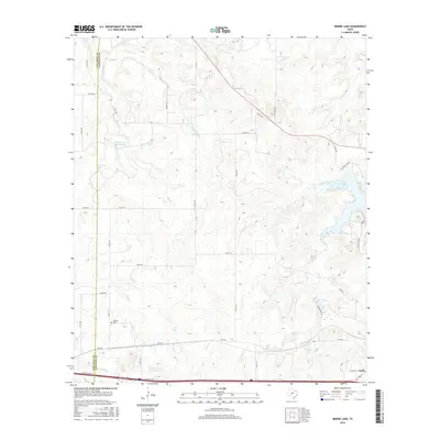
2016 Map of Bernie Lake
USGS Topo · Published 2016About this map
The boundary between Callahan Co and Eastland Co divides this West Texas landscape, where the rural settlement of Dothan sits near the southwestern corner. This area is defined by a complex network of waterways and reservoirs, most notably Lake Cisco in the east and the smaller Bernie Lake nearby. Local genealogy and history are anchored at the Dothan Cem, located just north of the I-20 Access Rd corridor. The terrain is deeply etched by various drainage systems, including the meandering paths of Cottonwood Cr, Sandy Cr, and Battle Cr. These streams feed several localized water bodies such as Battle Creek Channel Lake and the Dothan Water Station Lake, reflecting the vital role of water management in this cattle-and-oil-producing region of the Texas rolling plains.
Find a feature on this map
43 named features on this map. Tap any name to fly to it.
Don’t see what you’re looking for? This feature index may not catch every label — zoom into the map to look around manually.
Map Details
Editions of this 2016 Bernie Lake Map
This is the sole edition of this map. No revisions or reprints were ever made.
Other maps of this area

1890 · Breckenridge
USGS Topo · 1:125,000

1892 · Albany
USGS Topo · 1:125,000

1893 · Albany
USGS Topo · 1:125,000

1894 · Eastland
USGS Topo · 1:125,000

1931 · Baird
USGS Topo · 1:125,000

1932 · Baird
USGS Topo · 1:125,000

1954 · Abilene
USGS Topo · 1:250,000

1958 · Abilene
USGS Topo · 1:250,000

1965 · Indian Knoll
USGS Topo · 1:24,000
1965 · Moran
USGS Topo · 1:24,000