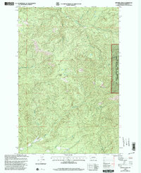
2000 Map of Bernier Creek
USGS Topo · Published 2003About this map
The Skookumchuck River and the headwaters of the Newaukum drainage system dominate this forested landscape in Lewis County at the turn of the 21st century. The map reveals a complex network of timber and access roads threading through the high country, where peaks like Windy Knob rise between deep drainages. Much of the eastern portion of the quadrangle lies within the Mt Baker - Snoqualmie National Forest, reflecting the region's long-standing connection to federal land management and the logging industry. The drainage patterns are meticulously recorded, showing the North Fork Newaukum River, South Fork Newaukum River, and smaller tributaries like Bernier Creek and Kearney Creek. This survey captures the character of the Washington cascades as a working forest, defined by its hydrology and the varying elevations that feed into the Chehalis River basin.
Find a feature on this map
11 named features on this map. Tap any name to fly to it.
Don’t see what you’re looking for? This feature index may not catch every label — zoom into the map to look around manually.
Map Details
Editions of this 2000 Bernier Creek Map
This is the sole edition of this map. No revisions or reprints were ever made.
Other maps of this area

1916 · Chehalis
USGS Topo · 1:125,000

1937 · Eatonville
USGS Topo · 1:125,000

1941 · Tanwax Lake
USGS Topo · 1:62,500

1943 · Willapa
USGS Topo · 1:62,500

1944 · Yelm
USGS Topo · 1:62,500

1944 · Ohop Valley
USGS Topo · 1:62,500

1949 · Ohop Valley
USGS Topo · 1:62,500

1949 · Yelm
USGS Topo · 1:62,500

1953 · Hoquiam
USGS Topo · 1:250,000

1954 · Onalaska
USGS Topo · 1:62,500