
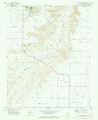
1974 Map of Bernstein
USGS Topo · Published 1977About this map
Hitchland and Bernstein anchor this mid-1970s survey of the High Plains, where the industrial infrastructure of the Panhandle meets the Oklahoma border. The landscape is defined by the energy and transportation corridors of Hansford County, most notably the Chicago Rock Island and Pacific railroad which cuts north-south across the terrain. This rail line provided essential access for the surrounding Oil and Gas Field, marked by numerous well sites that dot the survey area.
Find a feature on this map
11 named features on this map. Tap any name to fly to it.
Don’t see what you’re looking for? This feature index may not catch every label — zoom into the map to look around manually.
Map Details
Editions of this 1974 Bernstein Map
This is the sole edition of this map. No revisions or reprints were ever made.
Other maps of this area

1954 · Perryton
USGS Topo · 1:250,000

1958 · Perryton
USGS Topo · 1:250,000

1962 · Kimball
USGS Topo · 1:24,000

1962 · Hansford Camp
USGS Topo · 1:24,000

1962 · Waka SW
USGS Topo · 1:24,000

1968 · Hardesty
USGS Topo · 1:24,000

1968 · Guymon SW
USGS Topo · 1:24,000

1968 · Guymon SE
USGS Topo · 1:24,000

1973 · Gruver
USGS Topo · 1:24,000
1974 · Phillips Camp
USGS Topo · 1:24,000