
1973 Map of Gruver
USGS Topo · Published 1977About this map
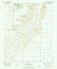
Gruver stands at the heart of this Panhandle landscape, where the Chicago Rock Island and Pacific railroad bisects the town. The settlement’s role as an agricultural and energy hub is evident through a sprawling network of pipelines and numerous sites marked as Gas Well or Oil Well across the plains. Local life is centered around the High Sch and the Athletic Field, while the town's industrial footprint is anchored by the prominent Grain Elevator near the tracks.
Find a feature on this map
16 named features on this map. Tap any name to fly to it.
Don’t see what you’re looking for? This feature index may not catch every label — zoom into the map to look around manually.
Map Details
Editions of this 1973 Gruver Map
This is the sole edition of this map. No revisions or reprints were ever made.
Other maps of this area

1954 · Perryton
USGS Topo · 1:250,000

1958 · Perryton
USGS Topo · 1:250,000

1962 · Kimball
USGS Topo · 1:24,000

1962 · Hansford
USGS Topo · 1:24,000

1974 · Hannas Draw East
USGS Topo · 1:24,000

1974 · Sunray 1 SE
USGS Topo · 1:24,000

1974 · Bernstein
USGS Topo · 1:24,000

1974 · Hannas Draw West
USGS Topo · 1:24,000

1974 · Sunray 1 NE
USGS Topo · 1:24,000
1974 · Phillips Camp
USGS Topo · 1:24,000