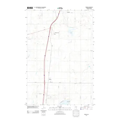
2013 Map of Beroun
USGS Topo · Published 2013About this map
Mission Creek serves as a central landmark in this portion of Pine County, situated along the namesake Mission Cr which flows toward the southern wetlands. The landscape is defined by its transition from the settled areas of Beroun and the southern edge of Hinckley into a more rural expanse of family-named roads and burial grounds. Genealogists will find three distinct cemeteries—Mission Creek Cem, Saint Joseph Cem, and Cech Cem—serving these local communities. To the south, the terrain descends toward Cross Lake at Norway Point, while various water bodies like Lawrence Mans Reservoir and Mud Lake dot the eastern side of the survey. The infrastructure is characterized by a network of rural routes, including Co Hwy-14 and MN-361, which link the various homesteads and crossroads of this Upper Midwest region.
Find a feature on this map
39 named features on this map. Tap any name to fly to it.
Don’t see what you’re looking for? This feature index may not catch every label — zoom into the map to look around manually.
Map Details
Editions of this 2013 Beroun Map
This is the sole edition of this map. No revisions or reprints were ever made.
Other maps of this area

1953 · Duluth
USGS Topo · 1:250,000

1953 · Stillwater
USGS Topo · 1:250,000

1955 · Stillwater
USGS Topo · 1:250,000

1958 · Stillwater
USGS Topo · 1:250,000

1958 · Duluth
USGS Topo · 1:250,000

1961 · Sandstone
USGS Topo · 1:62,500

1961 · Brook Park
USGS Topo · 1:62,500

1961 · Pine City
USGS Topo · 1:62,500

1965 · Stillwater
USGS Topo · 1:250,000
1968 · Kroschel
USGS Topo · 1:24,000