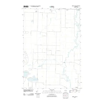
2010 Map of Berry Lake
USGS Topo · Published 2010About this map
The Oconto River winds through the eastern portion of this Oconto County landscape, defining the character of the small communities of Suring and Underhill in the first decade of the 21st century. The map documents a predominantly rural area punctuated by water bodies like Berry Lake and Moshawquit Lake, which sit amidst a grid of roads named for local families and flora, such as Harrys Rd and Balsam Ln.
Find a feature on this map
53 named features on this map. Tap any name to fly to it.
Don’t see what you’re looking for? This feature index may not catch every label — zoom into the map to look around manually.
Map Details
Editions of this 2010 Berry Lake Map
This is the sole edition of this map. No revisions or reprints were ever made.
Other maps of this area

1942 · Breed
USGS Topo · 1:48,000

1952 · Langlade
USGS Topo · 1:48,000

1952 · Mountain
USGS Topo · 1:48,000

1954 · Shawano
USGS Topo · 1:48,000

1954 · Iron Mountain
USGS Topo · 1:250,000

1955 · Green Bay
USGS Topo · 1:250,000

1956 · Gillett
USGS Topo · 1:62,500

1959 · Iron Mountain
USGS Topo · 1:250,000

1964 · Shawano
USGS Topo · 1:62,500
1973 · Hickory Corners
USGS Topo · 1:24,000