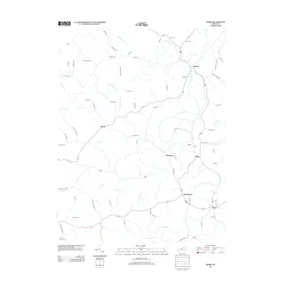
2013 Map of Berry
USGS Topo · Published 2013About this map
The S Fork Licking River carves a winding path through this northern Harrison County landscape, anchoring a series of small riverside and upland settlements. In the southern corner, the city of Berry serves as a primary hub, while the river's course to the north passes through the hamlets of Colemansville, Durbintown, and Morgan. The terrain is deeply dissected by numerous watercourses, including Crooked Cr and Snake Lick Cr, which have historically dictated the placement of homesteads and connector roads like Renaker-Berry Rd.
Find a feature on this map
81 named features on this map. Tap any name to fly to it.
Don’t see what you’re looking for? This feature index may not catch every label — zoom into the map to look around manually.
Map Details
Editions of this 2013 Berry Map
This is the sole edition of this map. No revisions or reprints were ever made.
Other maps of this area

1929 · Cynthiana
USGS Topo · 1:48,000

1930 · Falmouth
USGS Topo · 1:48,000

1934 · Cynthiana
USGS Topo · 1:62,500

1936 · Falmouth
USGS Topo · 1:62,500

1939 · Sadieville
USGS Topo · 1:62,500

1950 · Mason
USGS Topo · 1:24,000

1950 · Williamstown
USGS Topo · 1:24,000

1953 · Sadieville
USGS Topo · 1:24,000

1953 · Berry
USGS Topo · 1:24,000

1953 · Breckinridge
USGS Topo · 1:24,000