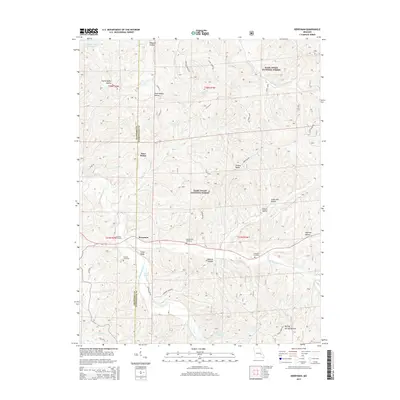
2015 Map of Berryman
USGS Topo · Published 2015About this map
The settlement of Berryman sits at the intersection of Crawford and Washington counties, surrounded by the heavy forest cover of the Mark Twain National Forest. This 2015 survey reveals a landscape where deep hollows like Henpeck Hollow and Smith Mill Hollow dictate the path of local travel. For those tracing regional roots, several family and community burial grounds are documented, including the Courtois Cemetery, Dobkins Cemetery, Whitby-Ellis Cemetery, and Cresswell Cemetery. The topography is defined by the winding course of Courtois Creek and Lost Creek, with elevated features such as Shirley Ridge and Cedar Ridge overlooking the drainages. Water bodies like Woods Lake and Timberlane Lake are visible alongside a network of forest roads, including Floyd Tower Road and Gobblers Knob Road, which provide access to the area's timber and recreational lands.
Find a feature on this map
48 named features on this map. Tap any name to fly to it.
Don’t see what you’re looking for? This feature index may not catch every label — zoom into the map to look around manually.
Map Details
Editions of this 2015 Berryman Map
This is the sole edition of this map. No revisions or reprints were ever made.
Other maps of this area

1901 · De Soto
USGS Topo · 1:125,000

1903 · Sullivan
USGS Topo · 1:125,000

1906 · Potosi
USGS Topo · 1:62,500

1943 · Berryman
USGS Topo · 1:62,500

1945 · Berryman
USGS Topo · 1:62,500

1946 · Richwoods
USGS Topo · 1:62,500

1947 · Sullivan
USGS Topo · 1:62,500

1948 · Richwoods
USGS Topo · 1:62,500

1949 · Saint Louis
USGS Topo · 1:250,000

1949 · Sullivan
USGS Topo · 1:62,500